DeepStateMap.Live is the definitive interactive online platform for tracking the hostilities in Ukraine, providing a detailed overview of the Russian-Ukrainian conflict. This comprehensive tool enables users to monitor the movements and positions of Russian military units with precision.
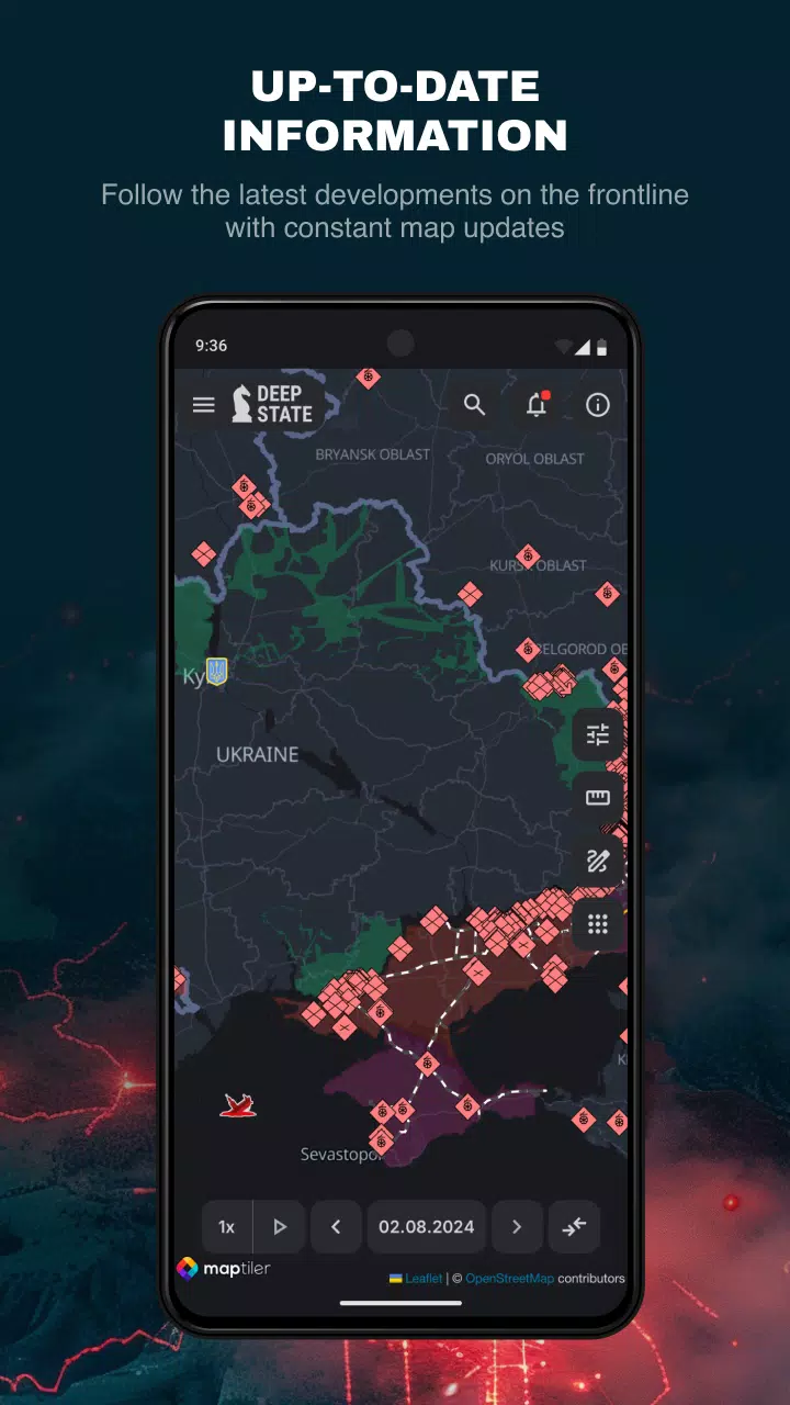
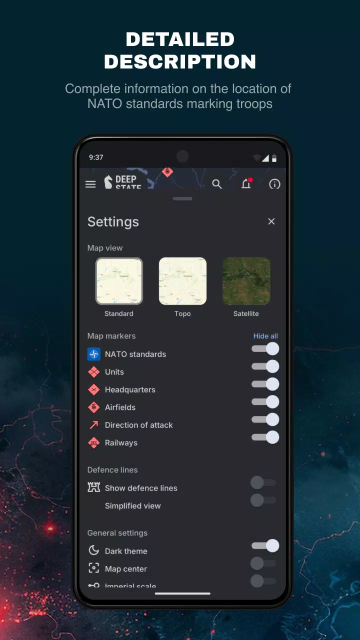
A key feature of DeepStateMap.Live is its data caching capability, ensuring that users have access to the latest information even in areas with limited internet connectivity. The map utilizes a variety of symbols to clearly indicate different statuses on the ground:
- Areas of Ukraine liberated from occupation within the last two weeks
- Liberated territories
- Territories requiring further verification
- Regions occupied by Russian forces
- The occupied territories of Crimea and ORDLO
- The region of Transnistria
- Locations of Russian military units, headquarters, airfields, and naval fleets
- Directions of Russian military offensives
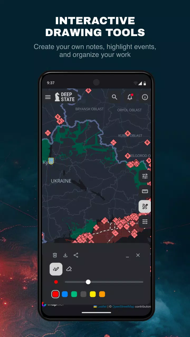
The map divides the territory into zones, each color-coded for easy identification, and marks the precise locations of Russian units and airfields. In addition to the map, the platform includes a news feed to keep users updated on the latest developments. Users can also measure distances between points on the map, enhancing the tool's utility for strategic analysis.
DeepStateMap.Live offers advanced functionalities such as the display of fire points using data from the NASA Firms system, allowing users to correlate these with the front lines. A specialized mode enables the measurement of the range of various artillery systems like HIMARS, M777, and CAESAR across the entire front line, providing invaluable data for military and strategic assessments.
What's New in Version 2.0.3
Last updated on Aug 13, 2024
The latest update, version 2.0.3, includes minor bug fixes and improvements. Users are encouraged to install or update to the newest version to benefit from these enhancements.