Introducing the definitive HEMAV app, your ultimate tool for monitoring your fields right from your mobile device. This innovative app seamlessly integrates with HEMAV LAYERS, harnessing the power of Artificial Intelligence alongside cutting-edge drone and satellite technology to deliver detailed agronomic reports and actionable recommendations.
With the HEMAV app, you have the power to:
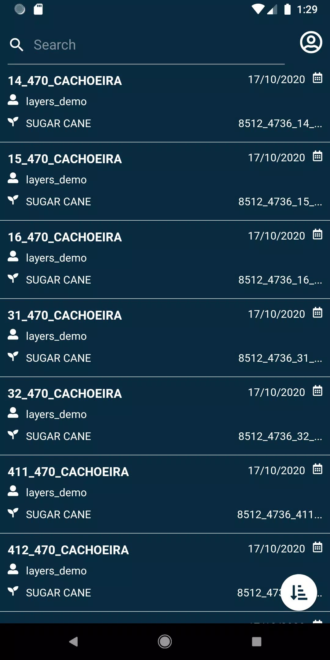
- View your fields with ease and precision.
- Search for specific fields using a wide array of filters, making it simple to find exactly what you need.
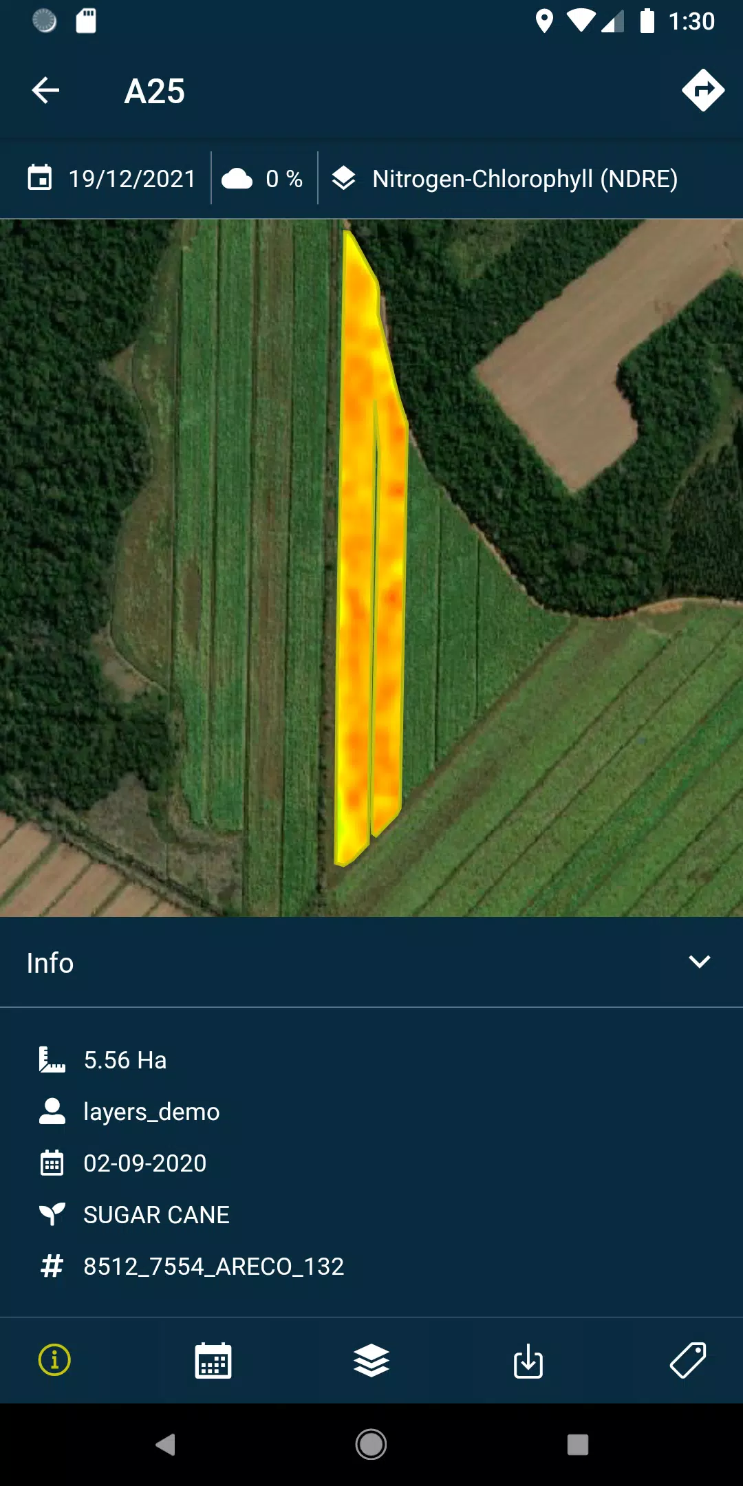
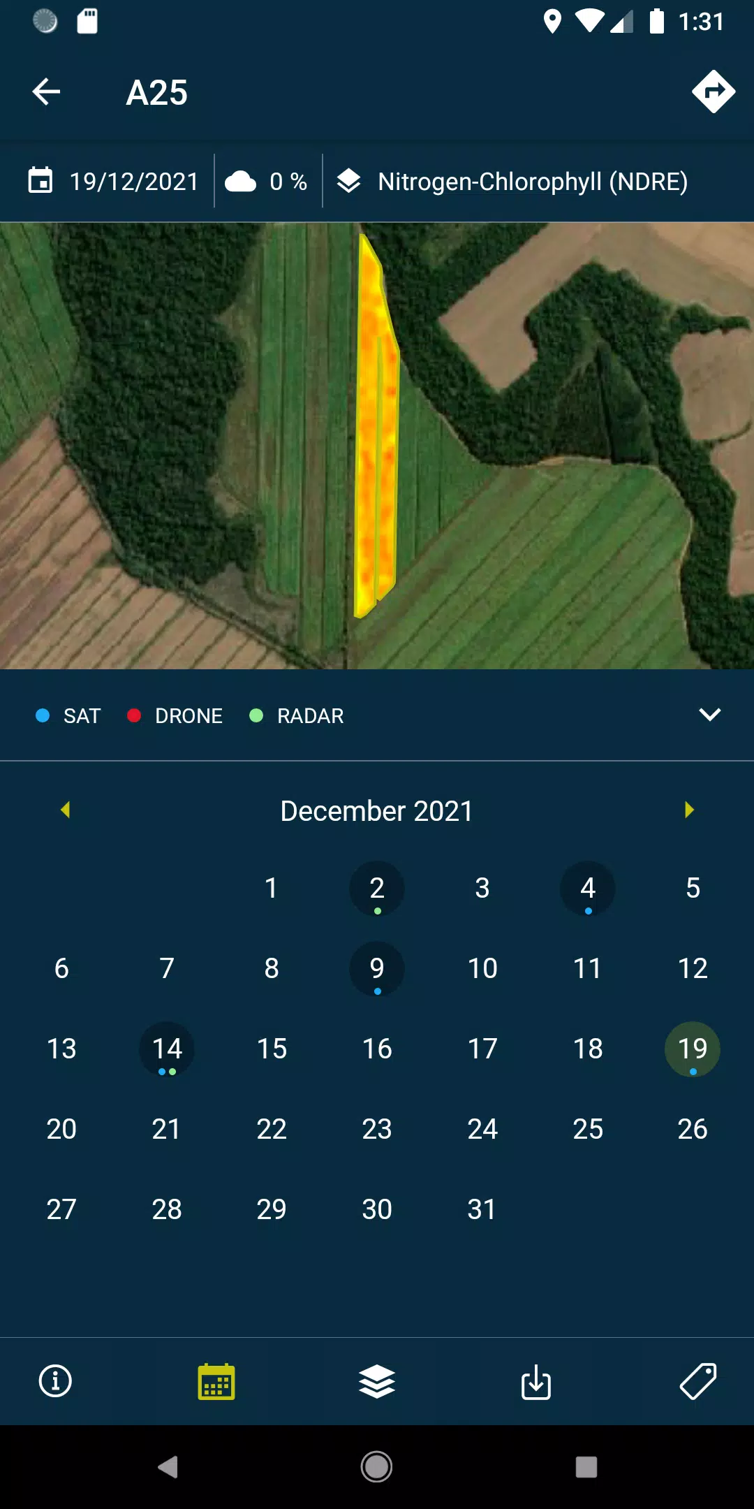
- Access and analyze the layers, which include comprehensive reports and recommendations, along with PDFs generated from each drone or satellite pass over your fields, available both online and offline for your convenience.
- Capture field photos, geolocate them, and add detailed comments to maintain meticulous control over your agricultural operations.
- Conduct field surveys and seamlessly integrate them into the system for further processing and analysis.
Please note that to unlock the full potential of this app, a subscription to HEMAV products is required.
Information About the HEMAV Precision Agriculture Service:
HEMAV's precision agriculture service leverages the advanced capabilities of the LAYERS artificial intelligence software. This technology provides the agricultural sector with precise agronomic recommendations, enhancing treatment efficiency and generating accurate crop production estimates in terms of both yield and quality.
What's New in the Latest Version 2.8.5
Last updated on Oct 19, 2024
- Bug fixes: Now includes improvements for pending sample uploads and enhanced cloud coverage filtering.