OfflineMaps provides you with access to an extensive selection of maps, ensuring a seamless navigation experience without the typical online hassles. With OfflineMaps, you can enjoy a completely private and uninterrupted mapping service, free from **advertisements, data sharing, monetization, analytics, and third-party libraries**. Are you tired of waiting for maps to load? With All-In-One OfflineMaps, once a map is displayed, it's stored and remains accessible, even without an internet connection, ensuring quick and efficient use.
- Looking for more than just road maps? You'll find a variety of options here;
- Do you frequent areas with poor network coverage? Your maps will still be available;
- Traveling abroad? Navigate with confidence;
- Concerned about data limits? OfflineMaps helps reduce your data usage.
★★ Maps ★★
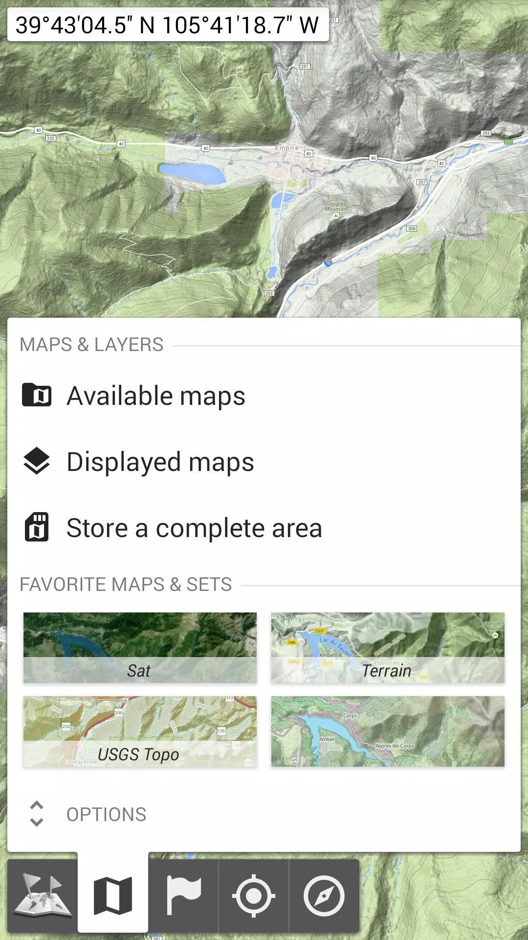
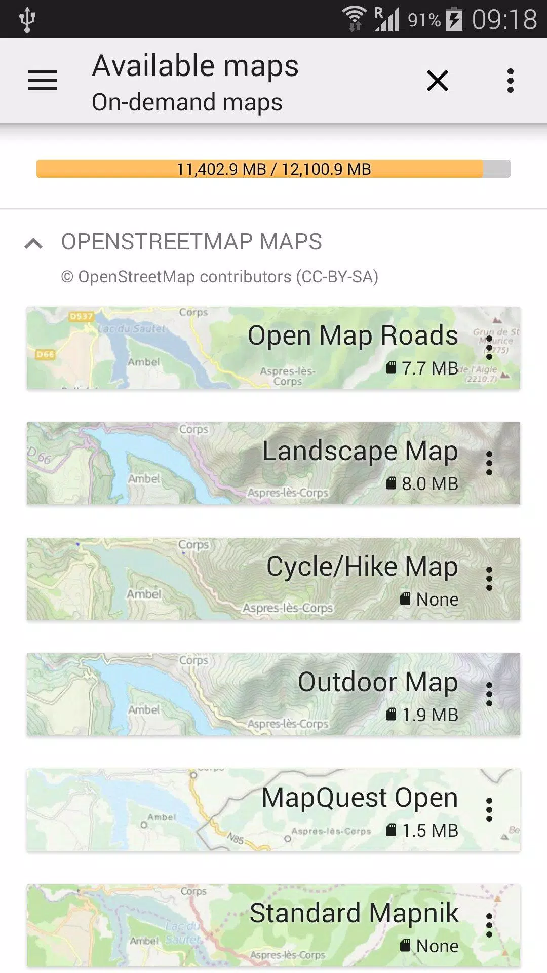
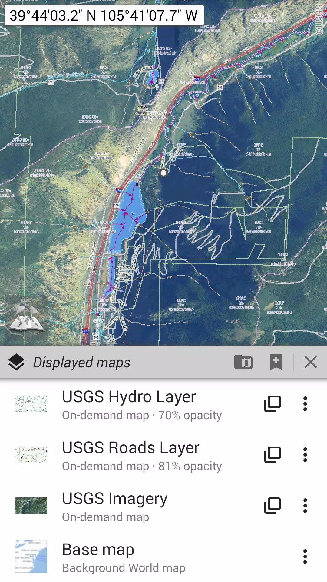
OfflineMaps offers an array of map types, including traditional road maps, detailed topographic maps, aerial (satellite) imagery, and a variety of overlay layers such as OpenStreetMap (Roads, Topo), USGS National Map (High-resolution topo, Aerial imagery), and Worldwide Military Soviet topo maps, among others.
- All maps can be layered with precise control over opacity;
- Easily select and save large areas with just a few clicks;
- Stored maps are clearly organized and can be deleted effortlessly.
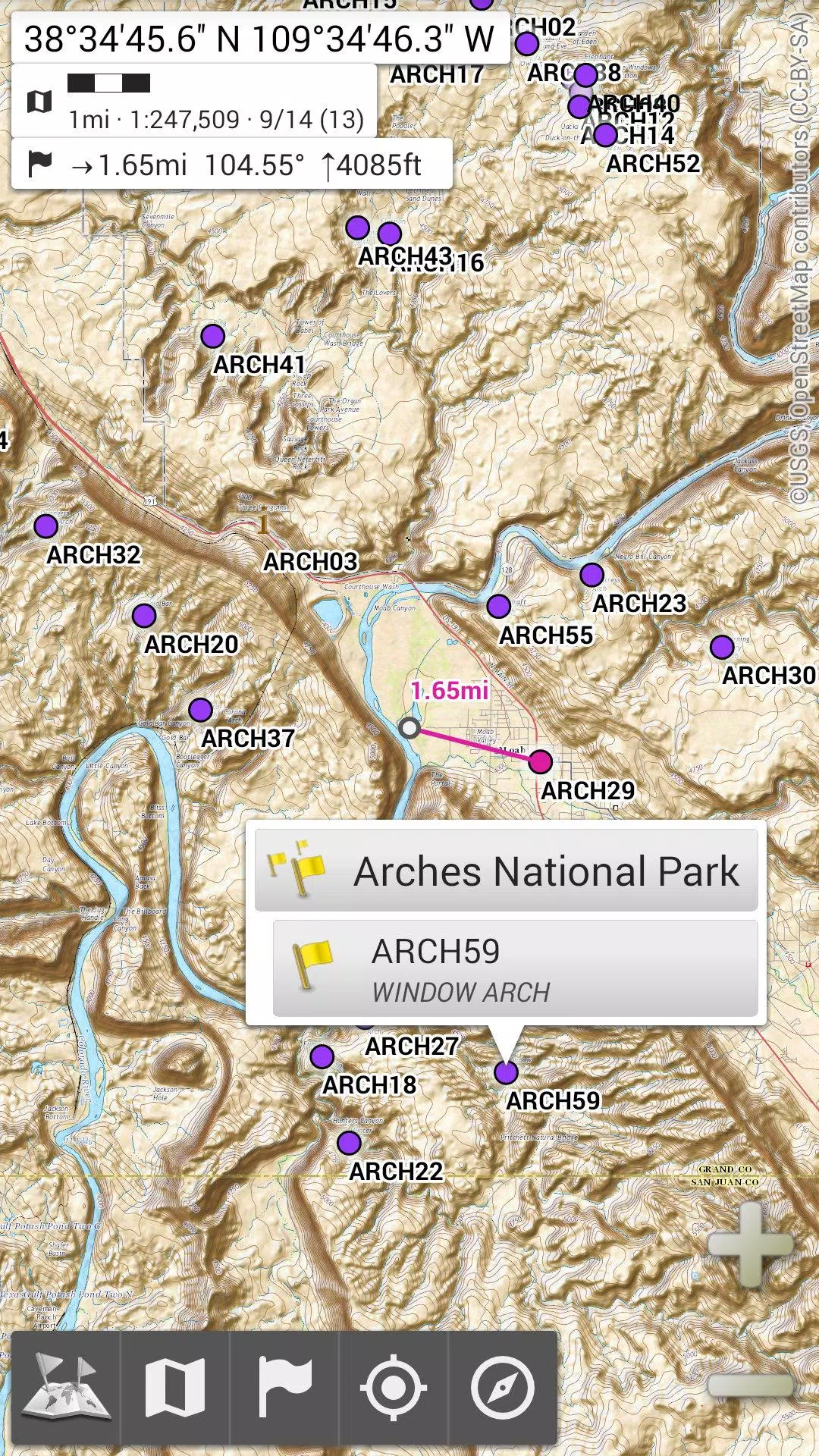
★★ Display, Store, and Retrieve Unlimited Placemarks ★★
Enhance your maps by adding various elements such as waypoints, icons, routes, areas, and tracks. Manage these effortlessly with the robust SD-Card Placemarks Explorer.
★★ On-Map GPS Location & Orientation ★★
Your real-time location and direction are clearly shown on the map, which can be rotated to align with your actual orientation (depending on your device's capabilities). Easily toggle this feature on or off to conserve battery life.
Additional features include:
- Metric, imperial, and hybrid distance units;
- GPS Latitude/Longitude and various grid coordinate formats (UTM, MGRS, USNG, OSGB Grid, Irish Grid, Swiss Grid, Lambert Grids, DFCI Grid, QTH Maidenhead Locator System, etc.);
- Import capabilities for hundreds of coordinate formats from spatialreference.org;
- On-map grid displays;
- Full-screen map view;
- Multi-touch zoom;
- And more...
★★ Need More? ★★
For the ultimate outdoor adventure, consider **AlpineQuest Off-Road Explorer**, the comprehensive outdoor solution built on All-In-One OfflineMaps. It includes a powerful GPS Track Recorder and additional features. Learn more at alpinequest.net/google-play.